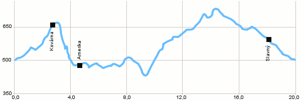
| Dist. |
Location |
Elevation |
Marking |
Description |
| 0,0 |
Suchý Důl |
500 m n.m. |
 |
4003 |
| 2,8 |
Kovárna |
663 m n.m. |
 |
 red tourist's marking red tourist's marking |
| 4,3 |
Amerika |
476 m n.m. |
|
red tourist's marking 4003, 4001 |
| 18,0 |
Slavný |
593 m n.m. |
|
4051 |
| 20,0 |
Suchý Důl |
500 m n.m. |
|
|
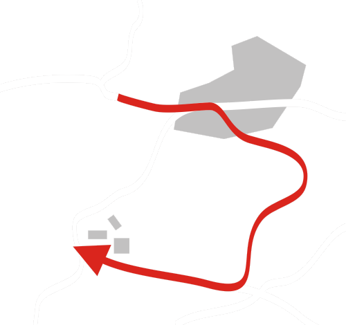
| | Kovárna - Along the green touristic track – Kovářova Rokle (Smith’s Gully) which is one of the gullies on the southwest side of Broumovské Stěny (rocks). There are a few caves in the gully from which Kovárna (Smithy), Myší Díra (Mouse Hole) and Mariánská Jeskyně (Mary’s Cave) are accessible. |
|