|
|
|
|
|
||||||||||
|
|
|
||||||||||||


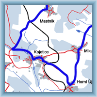
Cycling routes - Třebíč and surrounding
|
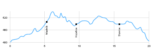
Length: 20 km Dificulty: easy Bikes: Easy trail, which starts and finish in Třebíč and leads mostly on roads of III.lass. The trace leads in Kojetice, where is castle Sadek and small vineyard. |
|
 Click to show full-size map
| ||||||||||||||||||||||||||||||||||||||||||||||||||||||||
| ||||||||||||||||||||||||||||||||||||||||||||||||||||||||||


|
