| Dist. |
Location |
Elevation |
Marking |
Description |
| 0,0 |
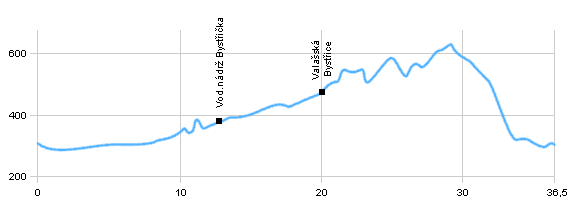
Valašské Meziříčí |
294 m n.m. |
 |
 cycle way no.501 cycle way no.501 |
| 5,5 |
Railway station Brňov |
310 m n.m. |
 |
 cycle way no.6018 cycle way no.6018 |
| 13,0 |
Water dam Bystřička |
380 m n.m. |
 |
|
| 15,0 |
Buš |
380 m n.m. |
|
|
| 20,0 |
Valašská Bystřice |
465 m n.m. |
|
road direction Vidče through Leskovec and Hlaváčky |
| 23,5 |
Cross road with red cycle way |
500 m n.m. |
 |
 cycle way no.6012 cycle way no.6012 |
| 36,5 |
Valašské Meziříčí |
294 m n.m. |
|
|
 | byl Vsetínská Bečvy |  | Difficult terrain with rising, on the lower quality surface |  | sometimes difficult terrain, beautiful views of the landscape |
|
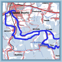
 Click to show full-size map


