|
|
|
|
|
||||||||||
|
|
|
||||||||||||
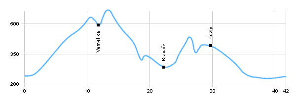
Cycling routes - The trace in Czech middle mts II.
|
Length: 42 km Dificulty: difficult Bikes: Difficult trace, which leads in Czech middle mts. The trace starts and finishes in Žandov |
|
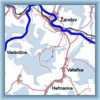 Click to show full-size map
| ||||||||||||||||||||||||||||||||||||||||||||||||||||||
| ||||||||||||||||||||||||||||||||||||||||||||||||||||||||

 |
Slovak Paradise |  |
