Advertising
West Tatras West Tatras West Tatras


Hiking, Trip to surroundings
Around Kraslice

Length: 15,4 km
Dificulty: medium
Circle: YES, Marking: marked

The trip starts by the Kraslice church and leads by the red track along Svatava river, around the village Tisová, Zelená Hora to Bublava. There at the crossroads it turns left and by the Nancy crossroad by Stříbrná it changes to the green track and leads to Stříbrná. Then it continues through the former Nová Ves from where it takes the yellow track and around Šibeniční Vrch back to Kraslice.

  Back

   Hiking, Trip to surroundings - Around  Kraslice
See the map

 Dist.   Location   Elevation   Marking   Description 
 0,0 
 Kraslice 
 537 m n.m.          
 1,8 
 Zelená Hora 
 639 m n.m.          
 6,0 
 Bublava 
 732 m n.m.         
 6,7 
 Bublava rozcestí 
 702 m n.m.        
 7,5 
 Nancy 
 632 m n.m.        
 9,1 
 Stříbrná 
 598 m n.m.        
 11,1 
 Bývalá Nová Ves 
 853 m n.m.        
 15,4 
 Kraslice 
 537 m n.m.        


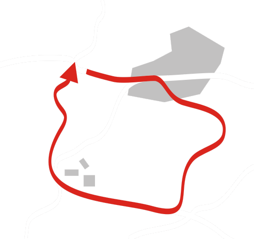
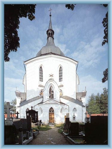
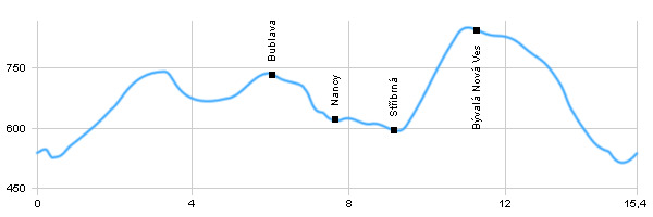
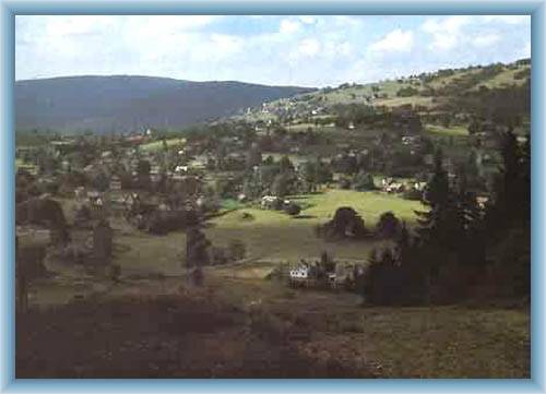
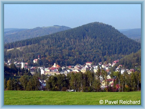
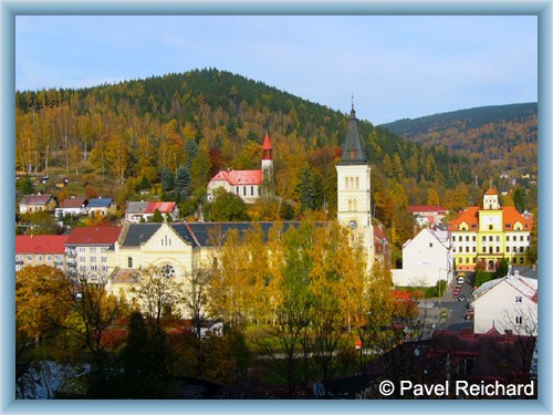
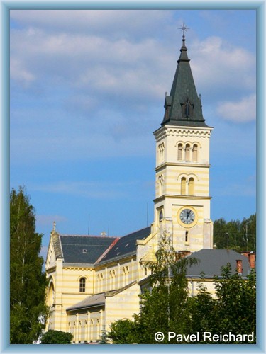
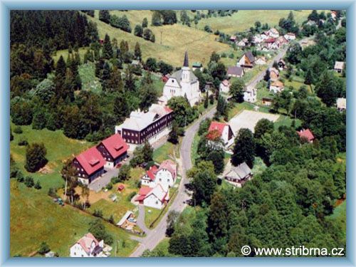
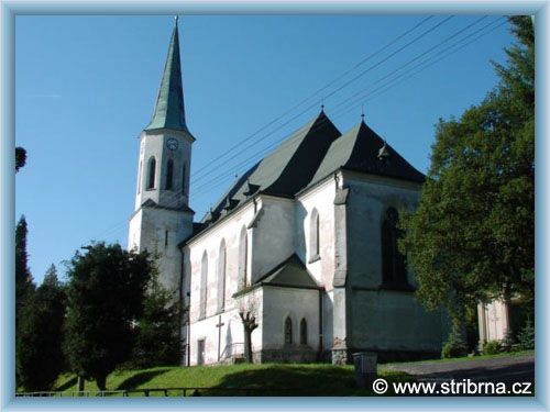
 The dominant of Kraslice is the Deen’ s Church of Corpus Cristi from 1893-1896 with a tower. There are statues of Mary and St.Jan Nepomucký from 18th century in front of the church. There is also an evangelic church and historical monuments at the cemetery. Most of the buildings are from 19th or 20th century.
 Bublava- Bublava is a well known recreational area mainly used during winter because there are many ski slopes in the near proximity.
 Stříbrná – There is a church of the Sacred Heart of Jesus.

Hiking, Trip to surroundings - Around  Kraslice


Photos of the route

Bublava
Church at Zelená mountain
Kraslice
Kraslice
Kraslice
Stříbrná
Stříbrná - Church


Back

  Accommodation Bublava
  Accommodation Kraslice
  Accommodation Stříbrná
  Accommodation Ore Mountains
Catalogue of accommodation
 
TOPlist