Advertising
West Tatras West Tatras West Tatras


Hiking, Trip to surroundings
Around Horní Blatná

Length: 4 km
Dificulty: easy
Circle: YES, Marking: partialy marked

This trip starts by the church in Horní Blatná and leads the same way as an educational trail but in the opposite direction. From the square it starts along the red and yellow track towards hill Blatenský Vrch. At the crossroads it turns right and leads to the top of Baltenský hill with a seeing tower. From there it leads through the Blatenský Příkop (Trench) and around a romantic pond back to Blatná.


 Dist.   Location   Elevation   Marking   Description 
 0,0 
 Horní Blatná 
 890 m n.m.         
 0,5 
 Crossroad 
 916 m n.m.         
 1,2 
 Vlčí a Ledová jáma 
 987 m n.m.         
 1,6 
 Blatenský vrch 
 1043 m n.m.          
 2,3 
 Blatenský příkop 
 964 m n.m.        
 2,7 
 Crossroad 
 960 m n.m.        
 4,0 
 Horní Blatná 
 890 m n.m.        


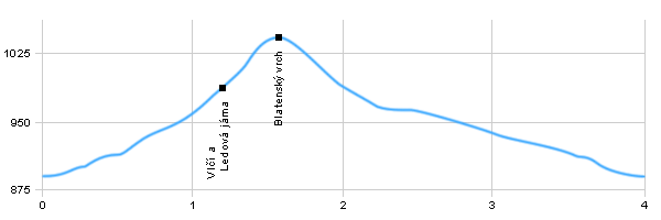
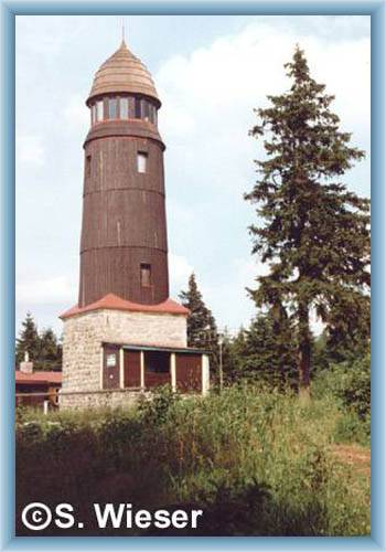
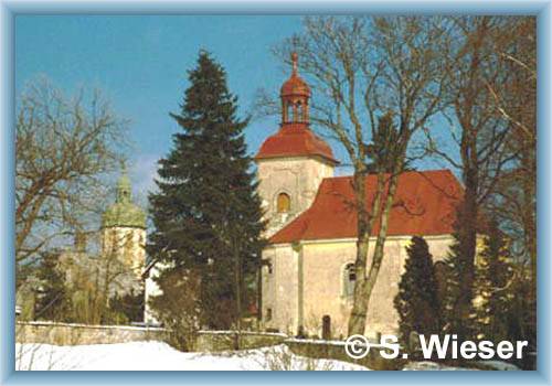
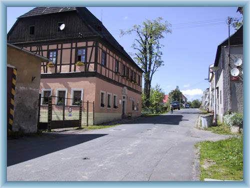
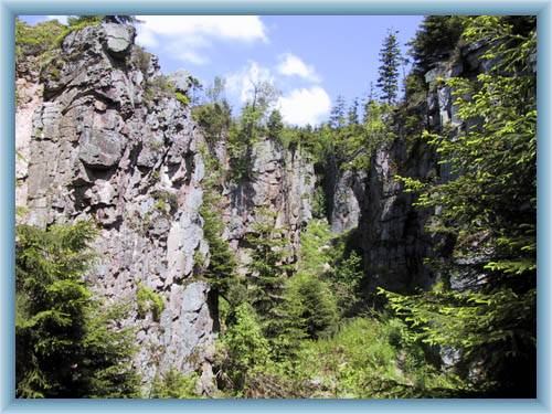
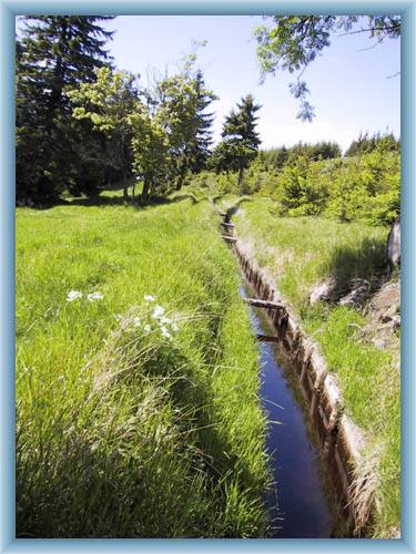
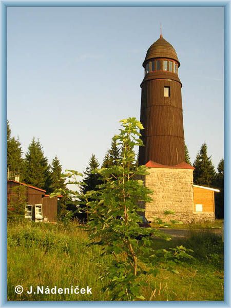
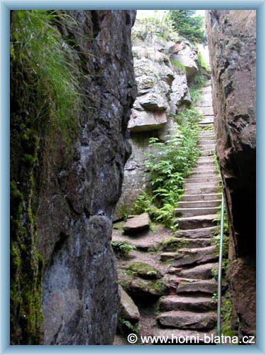
 Horní Blatná – An important mountain recreational center. The oldest buildings are gothic-renaissance. The church of St.Vavřinec from 16th century and the museum house are the most important historical sights.
 Vlčí a Ledová Jáma (Wolf and Ice Pit) – a protected natural sight which is a lapsed tin mine.
 Blatenský vrch – There is a seeing and television tower on the top of the hill. The seeing tower is 21m high and offers views from the complete height of 1044 AMSL
 Turning to Blatenský příkop (trench) – Blatenský trench is a technical sight. It was built 1540-44 to lead water to mines. It is 20km long and brings water from Boží Dar.

Hiking, Trip to surroundings - Around Horní Blatná


Photos of the route

View-tower on the top of Blatenský hill
Kirchen in Horní Blatná
Museum in Horní Blatná
Vlčí holes near Blatenský hill
Blatenský ditch
Vlčí jámy


Back

  Accommodation Horní Blatná
  Accommodation Pernink
  Accommodation Abertamy
  Accommodation Ore Mountains
Catalogue of accommodation
 
TOPlist