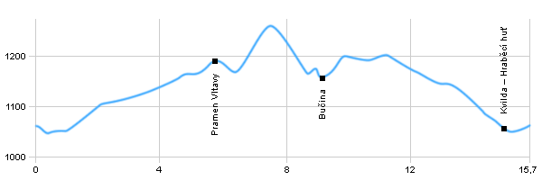
Length: 15,7 km
Dificulty: medium
Circle: YES, Marking: marked
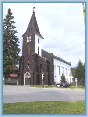
Our trip starts in the village of Kvilda next to a church and our path continues south along the blue tourist track to the local sawmill and abandoned Hraběcí huť (smelting house). From there we slowly go up through the valley of Teplá Vltava to the hillside of Černá hora (Black Mountain). After 5 km we should see an aisle, until recently (back in 1989) there was the so called iron curtain going through the area, which was essentially an electrical fence that blocked people from crossing the border. But it isn’t there anymore so we can go through it and continue, we should still go along the blue tourist track until we reach the source of Vltava, also called Černý Potok (Black Stream). Then we continue by the red tourist track to the crossroad of Bučina, from there we follow the green tourist track back to Hraběcí Huť and to Kvilda.
Drag the map with your mouse 
You can also use the directional arrows in the top-left corner.
Use the keys (+), (-) or the slider to zoom in and zoom out.

|
|
|
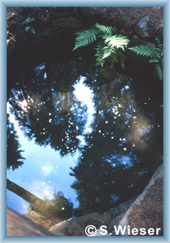
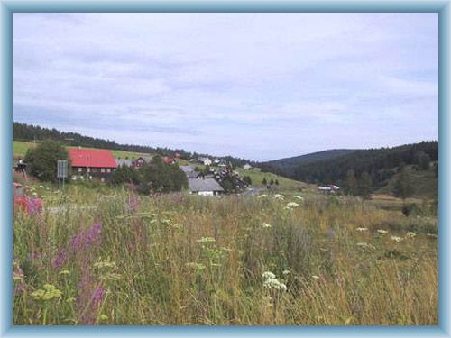
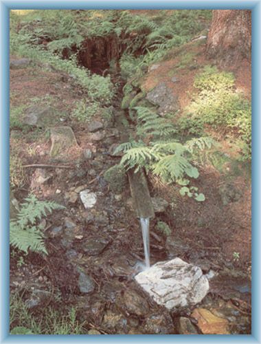
 | Source of Vltava – Source of the longest Czech river Vltava in the border zone of Šumava (Czechia-Germany), under the south-east hillside of Černá Hora in the height of 1172m. The name Vltava is used in the larger-river-like parts of the river, not in this area, because the river is stream-like so it’s called Černý Potok (Black Stream). Then the river’s name again changes to „Teplá Vltava“ (Warm Vltava), the part of the river which is called „Teplá Vltava“ is located North of Kvilda and South-East of Borová Lada and Lenor of Mrtvý luh. Then after some time the river connects with the other major source of Vltava called „Studená Vltava“ (Cold Vltava) and thus it creates the river of Vltava. |  | The Crossroad of Bučina – Defunct and the highest settlement of Šumava. We can find there a chapel from year 1992 and nice rest place with some information about the area and nice view over Knížecí Pláně (Knížecí Plains) and southern parts of Šumava. If visibility is good you can even the Alps, the Austrian Alps. Czech-German border crossing was built close to the settlement. Bučina is the scariest place in Šumava. |
|