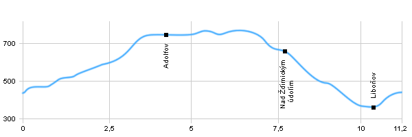
Length: 11,2 km
Dificulty: easy
Circle: YES, Marking: partialy marked
Trail trip begins in the village Telnice by the railway station and continues at the green sign along a road around Studena Stran and ski lifts in Adolfov, where at the junction turns left and continues for a while at the red sign to the crossroads U Adolfova. Here, turned left and goes at a blue sign through Ždírnické valley, and returned to the village Liboňov to Telnice.
Drag the map with your mouse 
You can also use the directional arrows in the top-left corner.
Use the keys (+), (-) or the slider to zoom in and zoom out.

|
|
|
| Dist. |
Location |
Elevation |
Marking |
Description |
| 0,0 |
Telnice |
440 m n.m. |
 |
 |
| 4,2 |
Adolfov |
752 m n.m. |
  |
 |
| 4,8 |
U Adolfova - crossroads |
742 m n.m. |
 |
|
| 7,8 |
Nad Ždírnickým údolím |
654 m n.m. |
|
|
| 10,4 |
Liboňov |
360 m n.m. |
|
|
| 11,2 |
Telnice |
440 m n.m. |
|
|
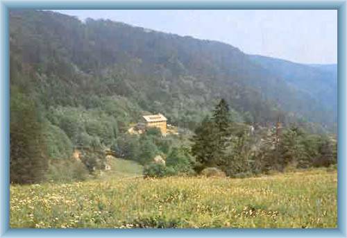
| | Major ski resort. Ski terrains are connected with the nearby Adolfov. On Rudný hill are ski slopes is a ski-jump. | | | Mountain village Adolfov is winter sports centre with slopes, ski country cross trail in the woods near the state border. |
|