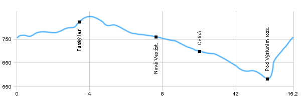
Length: 15,2 km
Dificulty: easy
Circle: YES, Marking: partialy marked
Trail trip begins in the village Výsluní and continues following the yellow sign through the protected area Na Loučkách at the crossroads by the railway station Výsluní. Here, the route turns right and goes following the red mark to the railway station in the village Nova Ves. Here again, turn right and follow the blue sign continues around Farského mlýna in the village Celna. Then continues through Prunéřovské valley and leads to the crossroads Pod Výsluní. Here turns right and after a yellow sign returns to the village Výsluní
Drag the map with your mouse 
You can also use the directional arrows in the top-left corner.
Use the keys (+), (-) or the slider to zoom in and zoom out.

|
|
|
| Dist. |
Location |
Elevation |
Marking |
Description |
| 0,0 |
Výsluní |
759 m n.m. |
 |
 |
| 2,7 |
Výsluní railway station |
800 m n.m. |
|
|
| 3,4 |
Farský les |
826 m n.m. |
 |
crossroads |
| 7,7 |
Nová Ves railway station |
759 m n.m. |
 |
|
| 10,0 |
Celná |
701 m n.m. |
|
 |
| 13,8 |
Pod Výsluním crossroads |
583 m n.m. |
|
|
| 15,2 |
Výsluní |
759 m n.m. |
|
|
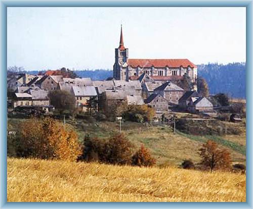
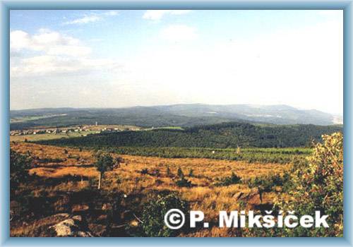
| | The town has a square floor plan with the Renaissance Square in the centre, which is dominant of the village, church of St.Václav. At the square is also Empire Town Hall. | | | The trail leads from the village through valley of Prunéřovský stream, which is the subject of a natural park. You will find here a group of commemorative trees. You can also go to the ruins of Gothic castle Hasištejn. |
|