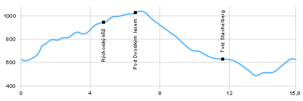
Length: 15,8 km Dificulty: medium Circle: YES, Marking: marked
The trip starts in the centre of Žacléř. From there it continues along the green touristic trail towards Královec and after that to the left up around some cottages steeply though the forest. Then it changes to the blue route to the crossing Pod Rýchorským Křížem (Under Rýchorský Cross) and to the baroque Rýcholský kříž (cross). There it turns left and continues near the Rýchorská Bouda (Rychory Cottage) and by the red sign trough Dvorský forest. Then it steeply descends through the forest and a trail between pastures to a small saddle where the biggest fort of WWII Stachelberg can be found. From the fort it leads to the crossing by the chapel in Prkenný Důl. From the chapel it rises along the car road and around the church back to Žacléř.
Drag the map with your mouse You can also use the directional arrows in the top-left corner. Use the keys (+), (-) or the slider to zoom in and zoom out.
Dist.
Location
Elevation
Marking
Description
0,0
Žacléř - střed
627 m n.m.
cyclo route 4081
0,6
Žacléř - porcelánka
628 m n.m.
1,6
Bílý Kříž
781 m n.m.
cyclo route 1A
4,4
Pod Rýchorským křížem
932 m n.m.
cyclo route 1A
4,9
Rýchorský kříž
961 m n.m.
cyclo route 1A
5,6
Kutná - crossroad
1002 m n.m.
7,4
Pod Dvorským lesem
987 m n.m.
crossroad yellow route
11,6
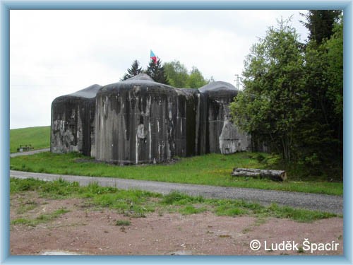
Tvrz Stachelberg
629 m n.m.
cyclo route 4210
14,6
Prkenný Důl
524 m n.m.
15,8
Žacléř - střed
627 m n.m.
More photos from around the route:
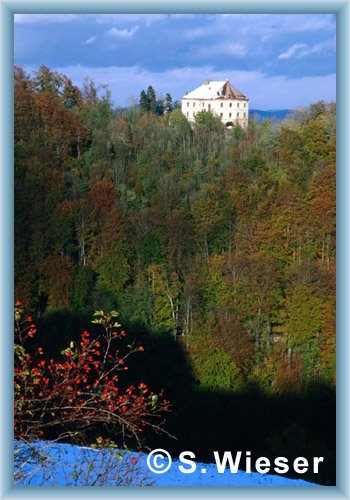
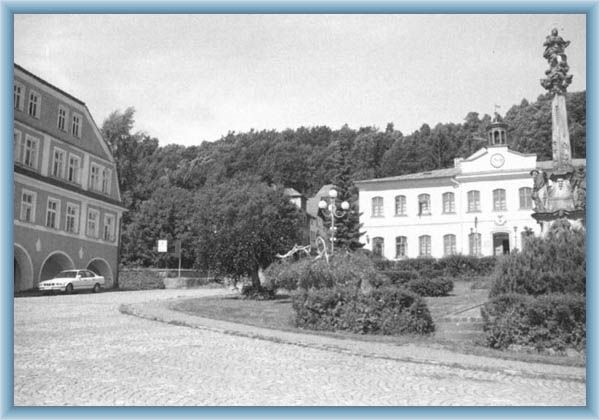
Žacléř – centre – A mining town mentioned in 1352. Since 1886 has been called Žacléř. The castle has been rebuilt in 18th century to a chateau. The originally baroque church from 16th century was rebuilt to baroque style in 1732 and changed a several times after that.
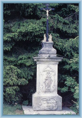
Pod Rýchorským Křížem (Under Rýchory Cross) – Rýchory – a treasury of nature beauty. According to legends gold was paned here in 1012. The Rýchory ridge is the most eastern part of the Giant Mountains. Rýchorská bouda (Rychory Cottage) lies in 1022 AMSL and was built in 1930, the baroque Rýchory cross is from 1804. The prettiest places are connected by the trail of the Čapek brothers, who were very famous writers.
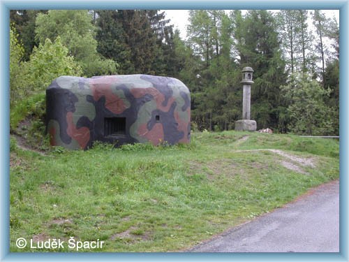
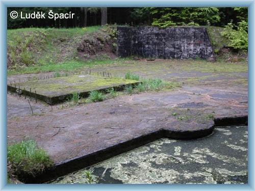
Fortress Stachelberg – The biggest Czechoslovak artillery fort, a part of the border fortification of Babí nad Trutnovem. The fort should have protect the nearby stress line and prevent the invasion of the German army trough Libavské saddle to Czech inland. The building started in 1937-38 but it hasn’t been finished. A vast broken-out underground /3,5 km long is filled with water now. The only concreted building of the 12 planed is the infantry blockhouse T-S73, where the museum of CS fortification can now be found (open Saturdays and Sundays, V.-IX.). There are long distance views form the fort.