|
|
|
|
|
||||||||||
|
|
|
||||||||||||


Hiking, Trip to surroundings
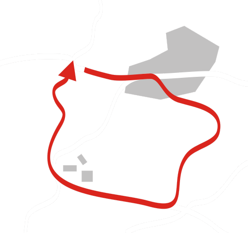
Around the Novodomské peat-bog
|
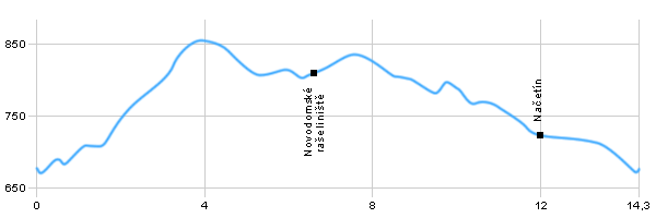
Length: 14,3 km Dificulty: medium Circle: YES, Marking: partialy marked The trip starts in Kalek where we follow the yellow track towards Nový Dům – Hájovna. We will pass a statue of St.Anne from 1823 along the way and then we continue to the Starý rybník (Old pond). From the pond we continue along yellow track to Nový Dům- Hájovna, which is a deserted building. There we change to the blue track towards the peat-bog. When we pass the Nový rybník (New pond) we enter the unmistakable countryside of the peat-bog. The trip will lead us to the car road leading to Načetín. There we leave the blue track and continue around the car road to Načetín (to the right). From Načetín we continue to the village of Kalek where our trip ends.  |
|
See the map
| |||||||||||||||||||||||||||||||||||||||||
| |||||||||||||||||||||||||||||||||||||||||||


|
