Hiking, Trip to surroundings Around Světlá pod Luží
Length: 12,8 km Dificulty: medium Circle: YES, Marking: marked
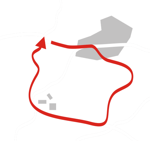
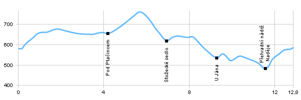
This trip starts in Horní Světlá pod Luží and continues by the red tourist track by a car road to Luž cottage and a settlement called Myslivny where it turns left and continues around Luž hill along the state border to Ptačinec hill to a crossroad. It turns left and around Vrabčí Kámen, Pěnkavčí Vrch, Pětikostelní Kámen and by the blue track to a crossroad called Nad Stožeckým Sedlem. From there it goes left by the yellow track slightly uphill under Bouřný hill and down to a small car road to a place called U Jána pod Malým Stohem where an interesting place called Sirný Pramen (Sulfur Spring). Then the trip crosses a car road and by the yellow track climbs up to the top of Malý Stoh and from there slightly down all the way to a water reservoir called Naděje (Hope). There at a crossroad it turns left and by the red track descends back to Horní Světlá pod Luží.
Horní Světlá - Horní Světlá is the highest placed mountain village in the Lusatian Mountains. There is an important resort for winter tourism. It is the starting point of the cross-country trails in the top parts of the Lusatian Mountains and there is also a downhill skiing center. Waltersdorf (Germany) ski resort is located on the northern side of the Luž. Running tracks are linked to both sides of the border and reach several tens of kilometers. In the lower part of the village at the border with Germany is a National Nature Reserve called Brazil.
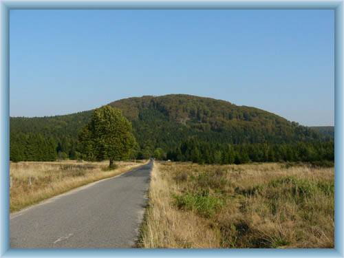
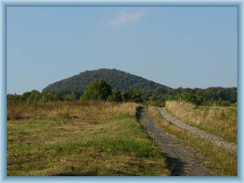
Cottage Luž - Luž (793m) is a distinctive phonolite mountain, the highest peak of the Lusatian Mountains. It lies directly on the Czech-German border. From the top there is a beautiful view from the Ore Mountains and Děčínský Sněžník through České středohoří, Vlhošť, Ralsko, Bezděz and Trosky up to Ještěd, the Jizera Mountains and the Krkonoše Mountains, to the north to the hills and the hills of Šluknovský výběžek and Upper Lusatia in Germany
Stožecké saddle - The Stožecké saddle is located in the Jedlovský hřbet between Pěnkavčí hora (Finch Mountain) and Stožec. Since 1805 a car road has been crossing the ridge linking Šluknovský výsek with the hinterland, today it called I/9 and connects Prague with Rumburk. In the saddle there is a parking lot. Thanks to the large elevation between the village of Lesná and the saddle (150 m to 3 km) car races used to be held there.
U Jána – The Sulfur Spring is located near the crossroad - a natural attraction, on the left bank of the Hamerský brook in the forest swamp are small spring pools. Stones and vegetation are covered with light ocher clots. The spring doesn’t contain sulfur but it is likely that the water previously contained hydrogen sulphide - hence the name of the sulfur spring.
K Kedové Jeskyni (Ice Cave) - Natural Monument Ice Cave Hope is a cracked pseudo cross cave in the fallow field on the north windward side of Suchý vrch. The entrance of the cave is at an altitude of 580 meters between large rock blocks. The actual cave is a 30m long crack. Inside the cave, cold air accumulates all year round, allowing the creation and survival of ice decorations. Some bats live in the cave. Since 1980, the cave has been closed to the public.
Naděje (Hope) reservoir - Naděje Dam is located in the deep wooded valley of the Hamerský spring below Suchý vrch. It was built according to the project of A. Niklas of Teplice in the years 1937-1938 and served as a reservoir for a mill and a saw drive in the nearby village of Hamr. The stone dam is over 91m long and 8.5m tall. The size of the flooded area is 1.16ha. Currently, the tank is not used as a water supply. Swimming is possible here but there are no beaches on the shores and the water is very cold even in the summer.