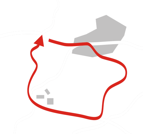
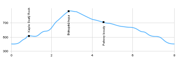
Advertising
Big Fatra Big Fatra Big Fatra


Hiking, Trip to surroundings
Around Zlaté Hory

Length: 8 km
Dificulty: medium
Circle: YES, Marking: marked

The trip starts on the square in Zlaté Hory. From there it continues along the green touristic track. After a while it climbs up to the little church on the hill of St.Roch built in 1666. Then it continues first through meadows and then forests to the car road form Zlaté Hory to Petrovice. From the car road it climbs steeply thru a forest to the top of Biskupská Kupa Hill with a view tower with a very nice view of the area. From the top it turns right and by a forest path it goes along the state border down to Petrovy Boudy. From there it goes on by the car road back to the place where it meets the green track. And following the green track it returns over the Hora Sv.Rocha to Zlaté Hory square.

  Back

   Hiking, Trip to surroundings - Around Zlaté Hory
See the map

 Dist.   Location   Elevation   Marking   Description 
 0,0 
 Zlaté Hory 
 409 m n.m.        
 0,9 
 Chapel Svatý Roch 
 523 m n.m.        
 2,8 
 Biskupská kupa 
 880 m n.m.         
 4,5 
 Petrovy boudy 
 713 m n.m.        
 8,0 
 Zlaté Hory 
 409 m n.m.        
More photos from around the route:

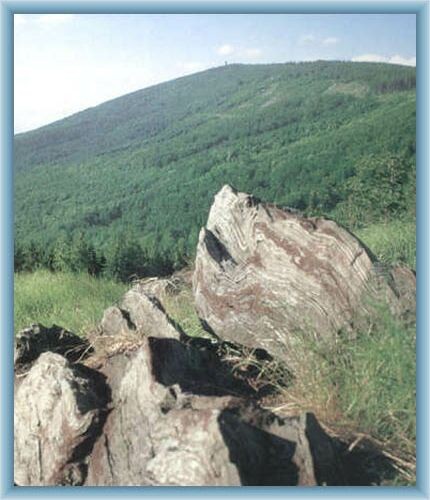
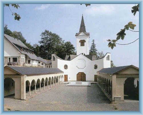
 St. Roch Chapel – The chapel was built on a hill out of the town Zlaté Hory during the 30 year war.
 Biskupská Kupa – An important hill on the border with Poland not far from Zlaté Hory. There is a stone view tower on the top from 1898 which is accessible to the public and offers a great view of the area. In 1998 a pedestrian border cross has been opened there.

Hiking, Trip to surroundings - Around Zlaté Hory


Photos of the route

Chapel in Zlaté Hory
Museum in Zlaté Hory
Sight of Bishop mount


Back

  Accommodation Česká Ves
  Accommodation Vrbno pod Pradědem
  Accommodation Jeseník
  Accommodation Jeseníky Mountains
Catalogue of accommodation
 
TOPlist