Advertising
Little Fatra Little Fatra Little Fatra


Hiking trail - Vidnava – Žulová

Length: 13,3 km
Dificulty: medium
Circle: NO, Marking: marked

This trip starts by Vidnava train station and goes along the green track to the town and along the Vidnavka river to Velká Kraše where it turns left and through open terrain continues to a touristic cottage. From the cottage it crosses a pine forest to the crossroad Smolný. From there it climbs up to Smolný hill and to a rock city. Then it returns to the crossroad and continues along the green track to the crossroad Plavný Potok where it turns to a forest trail by one of the oldest Oak trees of North Moravia and along the blue track to Bažantnice. Then it climbs up to Boží Hora (God’s Mountain) with a beautiful view. Then the trip rapidly descends to the train station in Žulová where it ends


 Dist.   Location   Elevation   Marking   Description 
 0,0 
 Vidnava 
 233 m n.m.         
 2,3 
 Velká Kraš 
 257 m n.m.         
 5,7 
 Rozcestí Smolný 
 354 m n.m.        
 6,0 
 Vrch Smolný 
 373 m n.m.         
 7,6 
 Plavný Potok 
 325 m n.m.        
 9,8 
 Bažantnice 
 350 m n.m.        
 12,1 
 Boží hora 
 516 m n.m.        
 13,3 
 Žulová 
 365 m n.m.        


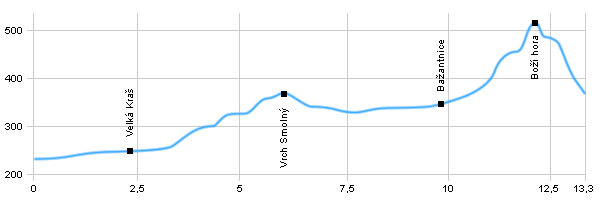
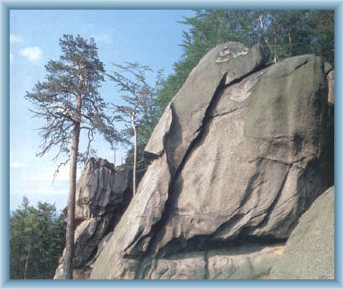
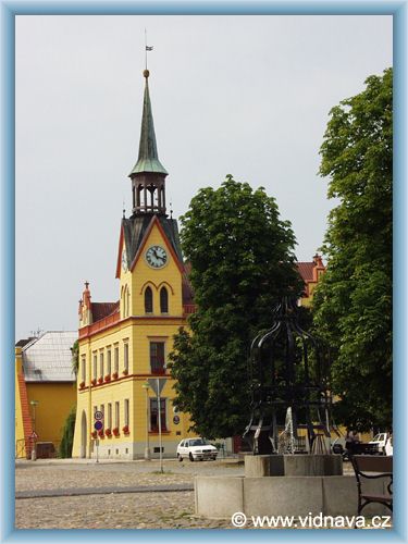
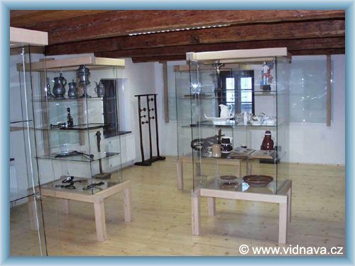
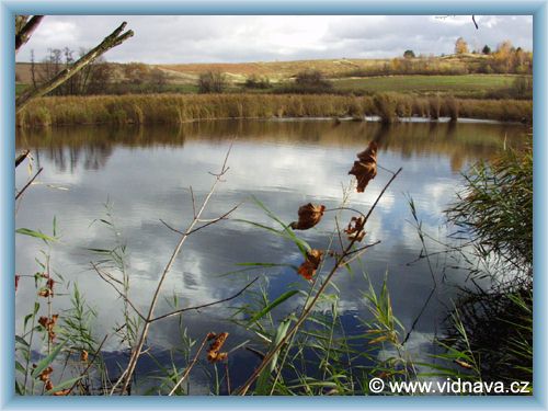
 Vidnava – The town is rich in cultural monuments. Among the most interesting ones is the square. There are Vidnavské marches nearby, which is a protected natural reserve.
 Velká Kraš –Velká Kraš lies on both banks of Vidnávka river. There is a filial chapel of St.Florian from 18th century and a nice swimming area. A little way from the swimming area there is an area called Habine where motorcycle meetings are held every summer.
 Smolný Hill – A hill in Žulovsko-Vidnavská upland. There is a rock city with many depressions known as Venus Bowls. They used to be considered pagan sacred places and connected to supernatural creatures. Nowadays this area is a protected natural creation and there is a viewpoint.
 Plavný Potok – One of the oldest oak trees of North Moravia is here and its age is estimated to be about 400 years.
 Boží Hora (God’s Hill) – The highest point of Žulovsko-Vidnavská upland. It is easily recognizable from afar because of the tower of the small church standing on top. The church was built in 1856 and there is a nice view from it.
 Žulová –The town is located on the confluence of Vidnávka and Stříbrný Potok creeks . There are Rychlebské mountains West of the town. Sights: Church of St.Joseph, parts of former gothic castle Frýberk, stone bridge etc.

Hiking trail - Vidnava – Žulová


Photos of the route

View-rock on the top of Smolný hill
Vidnava - Townhall
Vidnava - Museum
Vidnava


Back

  Accommodation Černá Voda
  Accommodation Nová Seninka
  Accommodation Vojtíškov
  Accommodation Jeseníky Mountains
Catalogue of accommodation
 
TOPlist