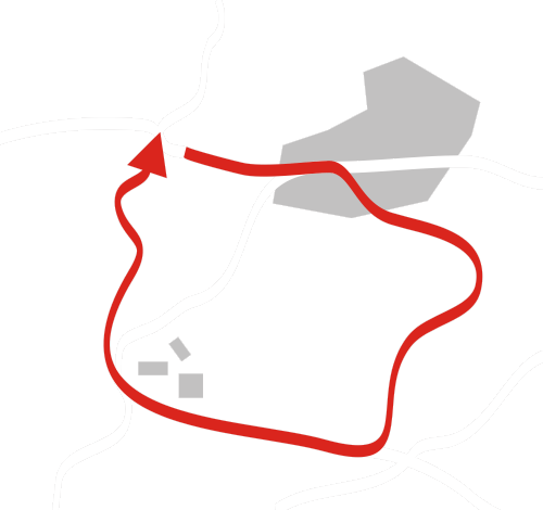
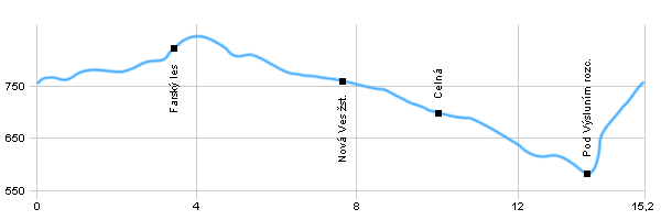
| Dist. |
Location |
Elevation |
Marking |
Description |
| 0,0 |
Výsluní |
759 m n.m. |
 |
 |
| 2,7 |
Výsluní railway station |
800 m n.m. |
|
|
| 3,4 |
Farský les |
826 m n.m. |
 |
crossroads |
| 7,7 |
Nová Ves railway station |
759 m n.m. |
 |
|
| 10,0 |
Celná |
701 m n.m. |
|
 |
| 13,8 |
Pod Výsluním crossroads |
583 m n.m. |
|
|
| 15,2 |
Výsluní |
759 m n.m. |
|
|
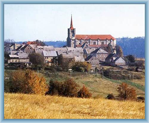
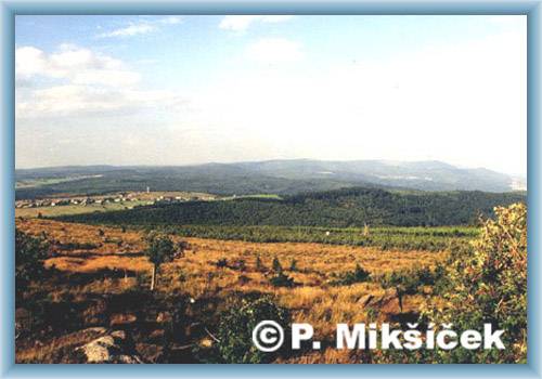
| | The town has a square floor plan with the Renaissance Square in the centre, which is dominant of the village, church of St.Václav. At the square is also Empire Town Hall. | | | The trail leads from the village through valley of Prunéřovský stream, which is the subject of a natural park. You will find here a group of commemorative trees. You can also go to the ruins of Gothic castle Hasištejn. |
|